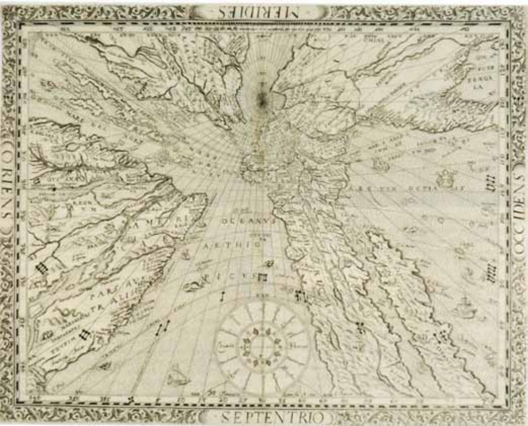
An untitled map of the world, 1640 , which made £4500 in Dominic Winter's (19.5% buyer's premium) sale of March 1
A second state example of a map first seen in the 1610 first edition of the Speculum of Franz Ritter, a German mathematician and astronomer, it is a projection that takes the North Pole as its centre, as if it were a sundial, with landmasses drawn to scale in proportion to their distance from that point.